Credit: NOAA
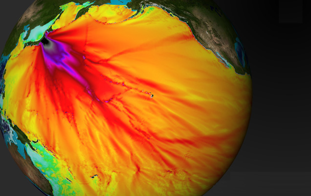
The magnitude-8.9 quake that struck Japan at 2:46 p.m. local time on Friday spawned coast-slamming tsunamis that will cross the Pacific in less than 21 hours. The tsunami first reached a monitoring buoy just minutes after the quake occurred, and soon thereafter scientists released a forecast of wave heights and arrival times. Colors in this image depict peak wave heights. Near the undersea source of the temblor, about 375 kilometers north-northeast of Tokyo, and southeast of that epicenter, where much of the quakes energy was focused, the height of the tsunami wave likely exceeded 2.5 meters (depicted in black). But across most of the Pacific, the open-ocean height of the waves, which race across the sea at jetliner speeds, probably remained less than 20 centimeters (yellow and orange).
by Sid Perkins
Posted in
Asia/Pacific |
Geochemistry, Geophysics